

aerosurv
Professional aerial drone surveying services.
'We have a passion for property'

Fast, effective and efficient drone surveying services
Hello and welcome! I'm Ryan Jordan, an independent drone pilot specialising in aerial surveying and photography. With a passion for innovation and a keen eye for detail, I leverage the power of drone technology to capture stunning aerial imagery and gather precise data for a variety of applications.
At Aerosurv LTD, I offer personalised drone services tailored to meet your unique needs. Whether you're looking to capture breathtaking aerial photos, conduct detailed site surveys, or create captivating marketing materials, I've got you covered. My state-of-the-art drones are equipped with high-resolution cameras and advanced sensors, ensuring crisp, clear, and accurate results every time.
What sets me apart is my commitment to quality, professionalism, and customer satisfaction. With years of experience in the drone industry, I bring a wealth of knowledge and expertise to every project I undertake. I take the time to understand your specific requirements and strive to exceed your expectations with exceptional service and results.
Navigating the skies to capture the perfect shot or gather vital data is not just a job for me, it's a passion. I take great pride in delivering high-quality aerial solutions that help my clients make informed decisions, showcase their properties, or tell their stories from a unique perspective.
Explore my website to learn more about the services I offer, view samples of my work, and discover how aerial drone services can add value to your project. Whether you're a homeowner, business owner, or fellow drone enthusiast, I look forward to collaborating with you and bringing your vision to life from above.
Thank you for considering Aerosurv LTD as your go-to independent drone pilot. Let's take your project to new heights together!


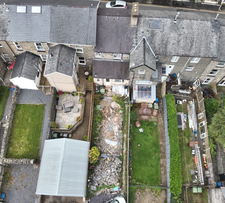
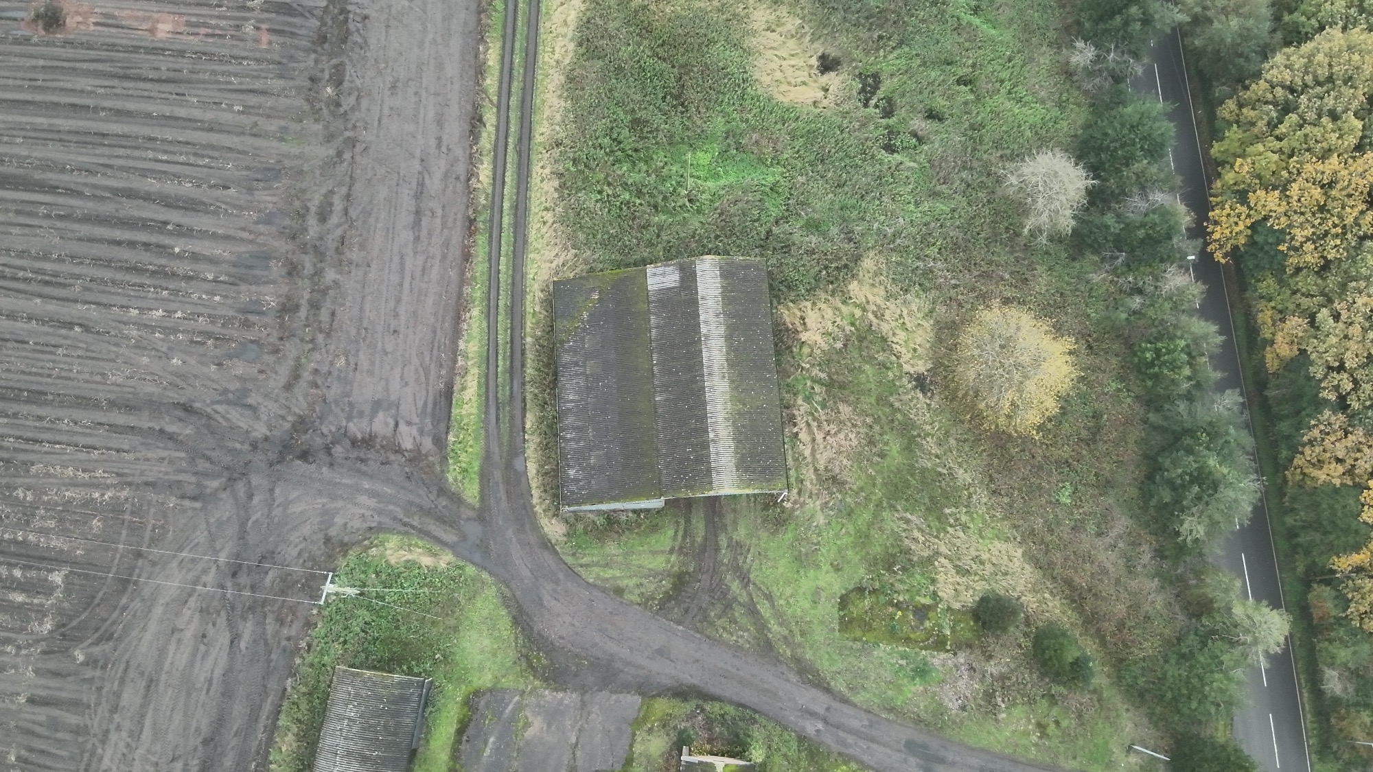
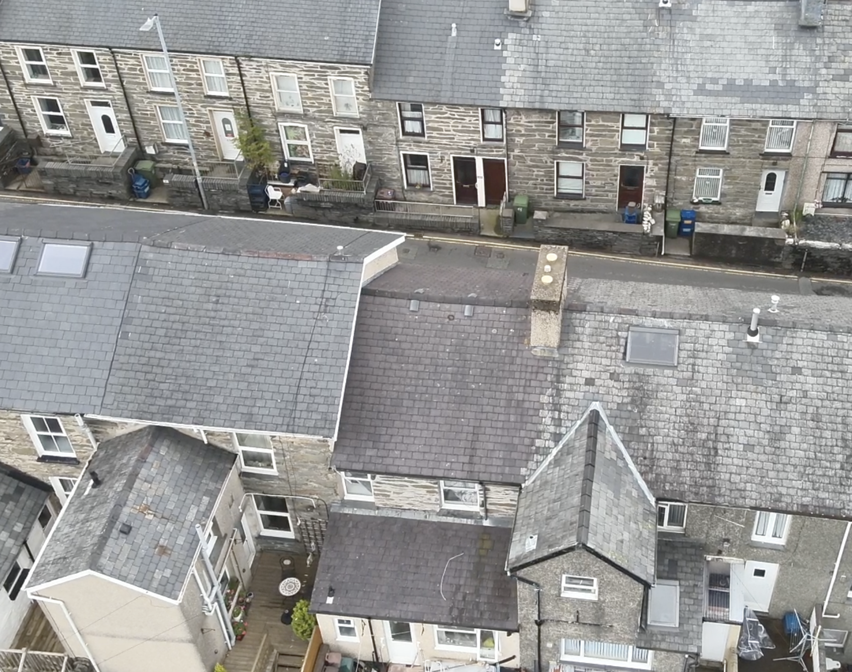
How Drones are used for Roof Inspections
Drones have revolutionized the way roof surveying is conducted, offering a safer, more efficient, and cost-effective alternative to traditional methods. Here's how drones are used for roof surveying:
1. Aerial Inspection: Drones equipped with high-resolution cameras can capture detailed aerial images of roofs, providing a clear view of the entire structure from various angles. This allows inspectors to identify potential issues such as cracks, leaks, or damage without the need for physical access.
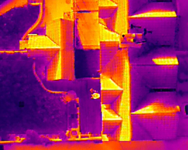
2. Thermal Imaging: Advanced drones can be equipped with thermal imaging cameras to detect temperature variations on the roof's surface. This technology is particularly useful for identifying areas of moisture infiltration, insulation defects, or hidden leaks that may not be visible to the naked eye.
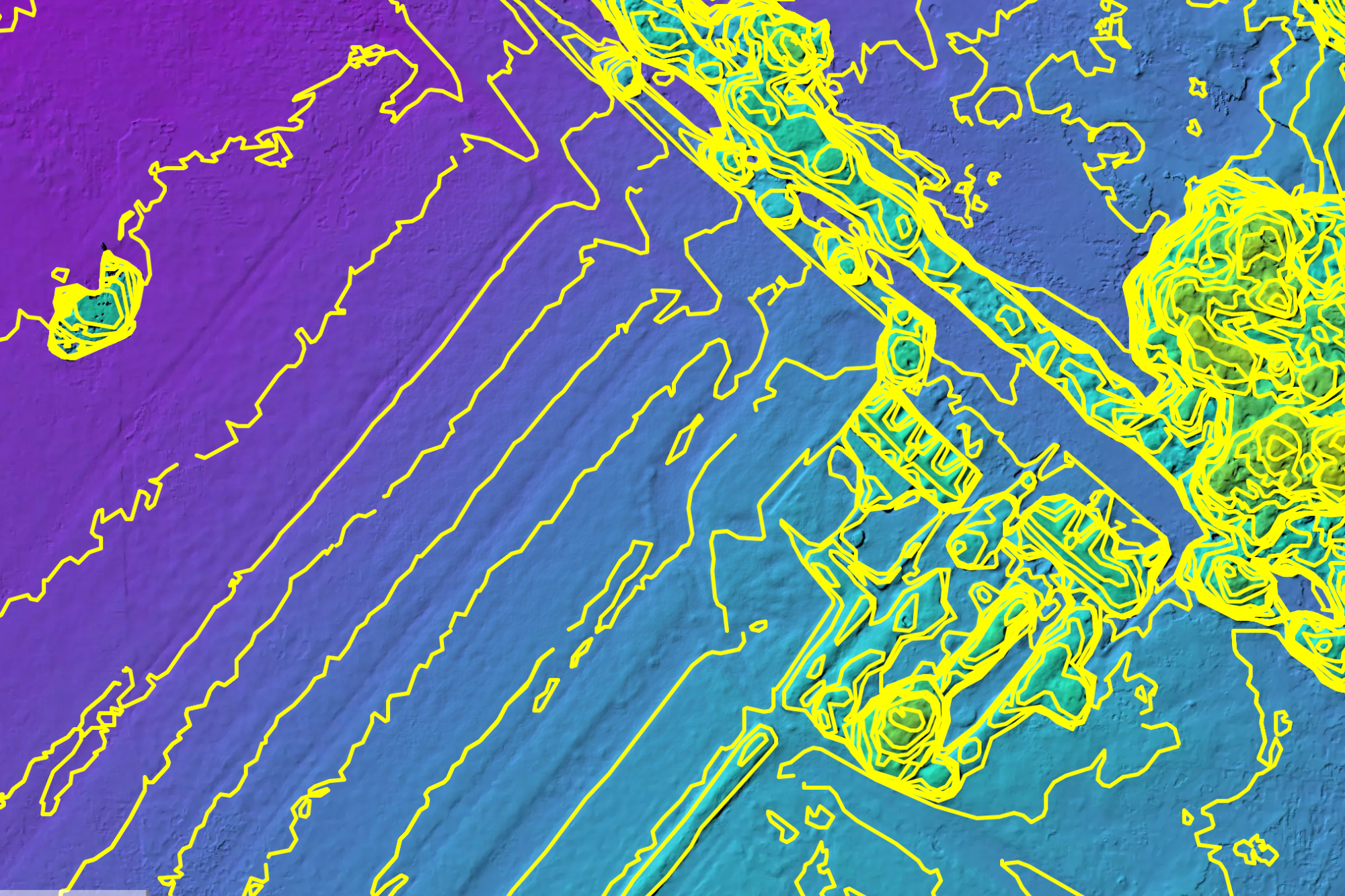
3. 3D Mapping and Modeling: Drones can create accurate 3D maps and models of roofs using photogrammetry techniques. This allows for precise measurements, volume calculations, and detailed visualizations of the roof's condition, aiding in planning repairs or renovations.
4. Safety: Using drones eliminates the need for inspectors to climb ladders or walk on potentially unsafe roofs, reducing the risk of accidents and injuries. Drones can access hard-to-reach areas and provide close-up inspections without putting personnel in harm's way.
5. Time and Cost Efficiency: Drone surveys can be completed in a fraction of the time compared to traditional methods, leading to significant cost savings. With faster data collection and analysis, property owners, insurers, and contractors can make timely decisions and prioritize repairs or maintenance tasks more effectively.
6. Accessibility: Drones can easily access roofs of all shapes, sizes, and heights, including steep or uneven surfaces that may be challenging or dangerous for human inspectors. This ensures comprehensive coverage and thorough inspections of the entire roof structure.
7. Documentation and Reporting: The data collected by drones can be processed and analyzed to generate comprehensive reports, complete with annotated images, videos, and recommendations. This documentation serves as valuable evidence for insurance claims, property assessments, and maintenance planning.
In summary, drones have transformed the roof surveying process by offering a versatile, efficient, and safe solution for inspecting and assessing the condition of roofs. By leveraging the capabilities of drone technology, property owners, inspectors, and contractors can obtain accurate and actionable information to maintain the integrity and longevity of roofing systems effectively.
CAA Operational Authorisation
DJI Enterprise Thermal Drones
Public Liability Insurance EC785/2004
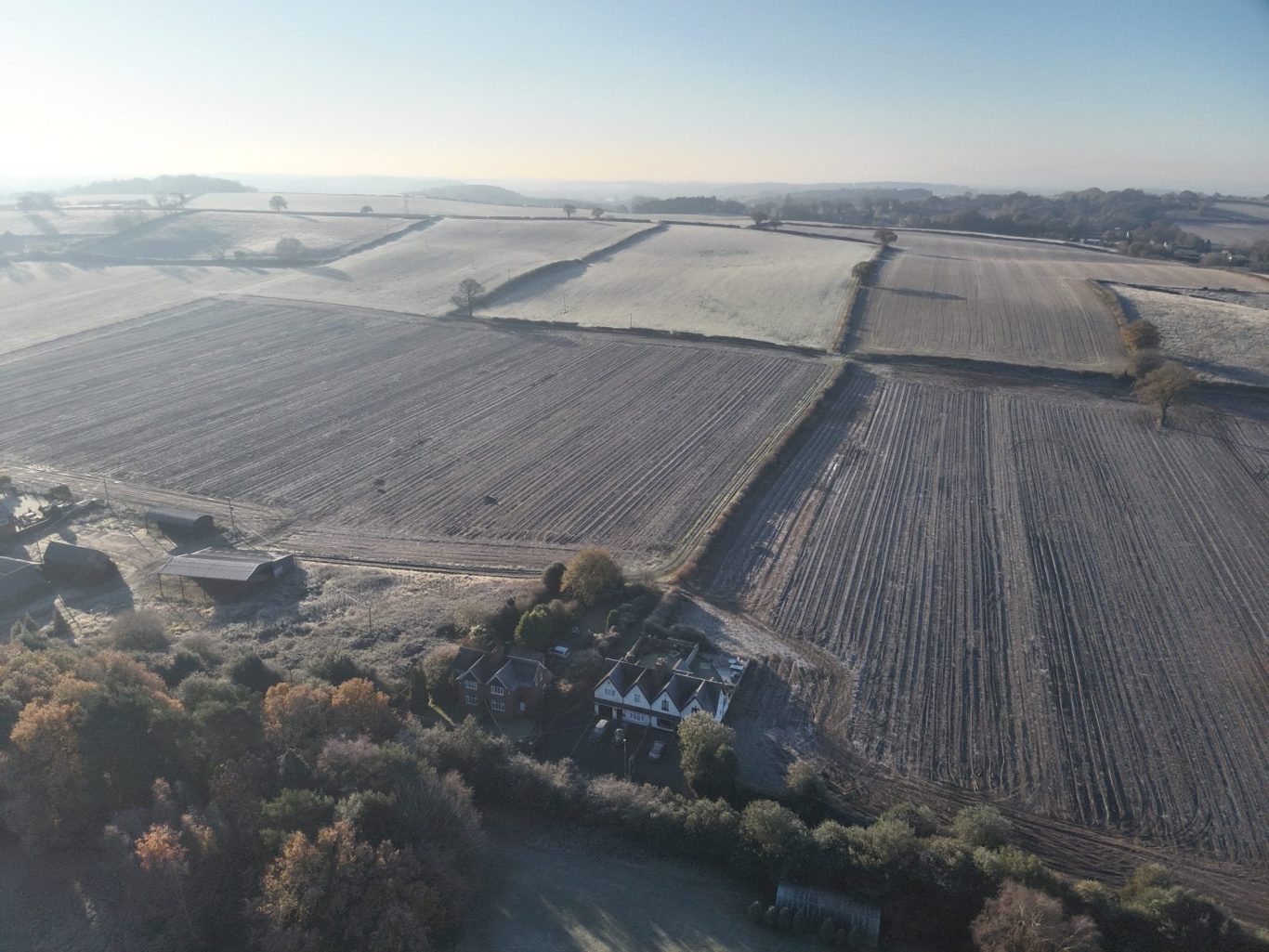
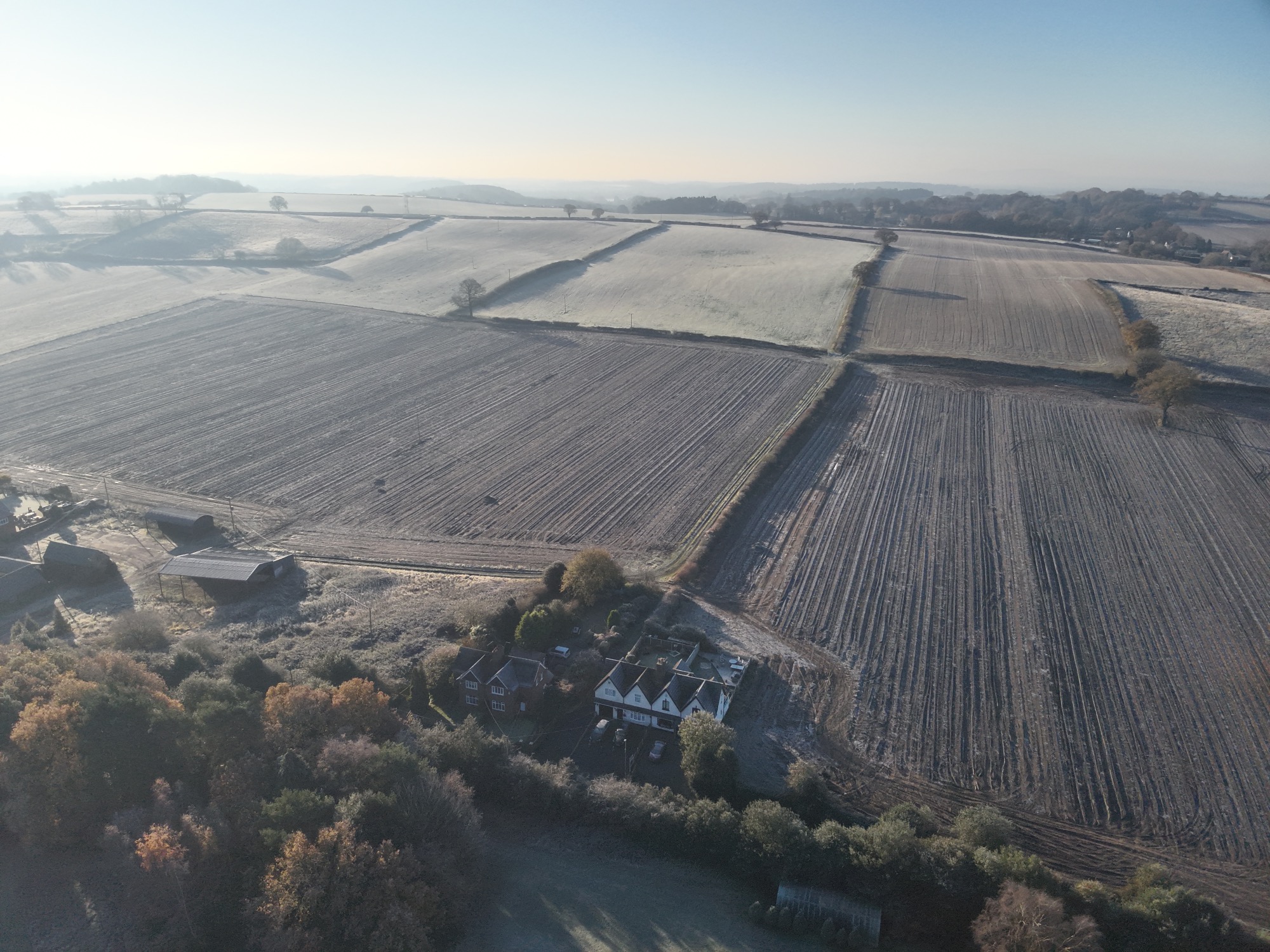
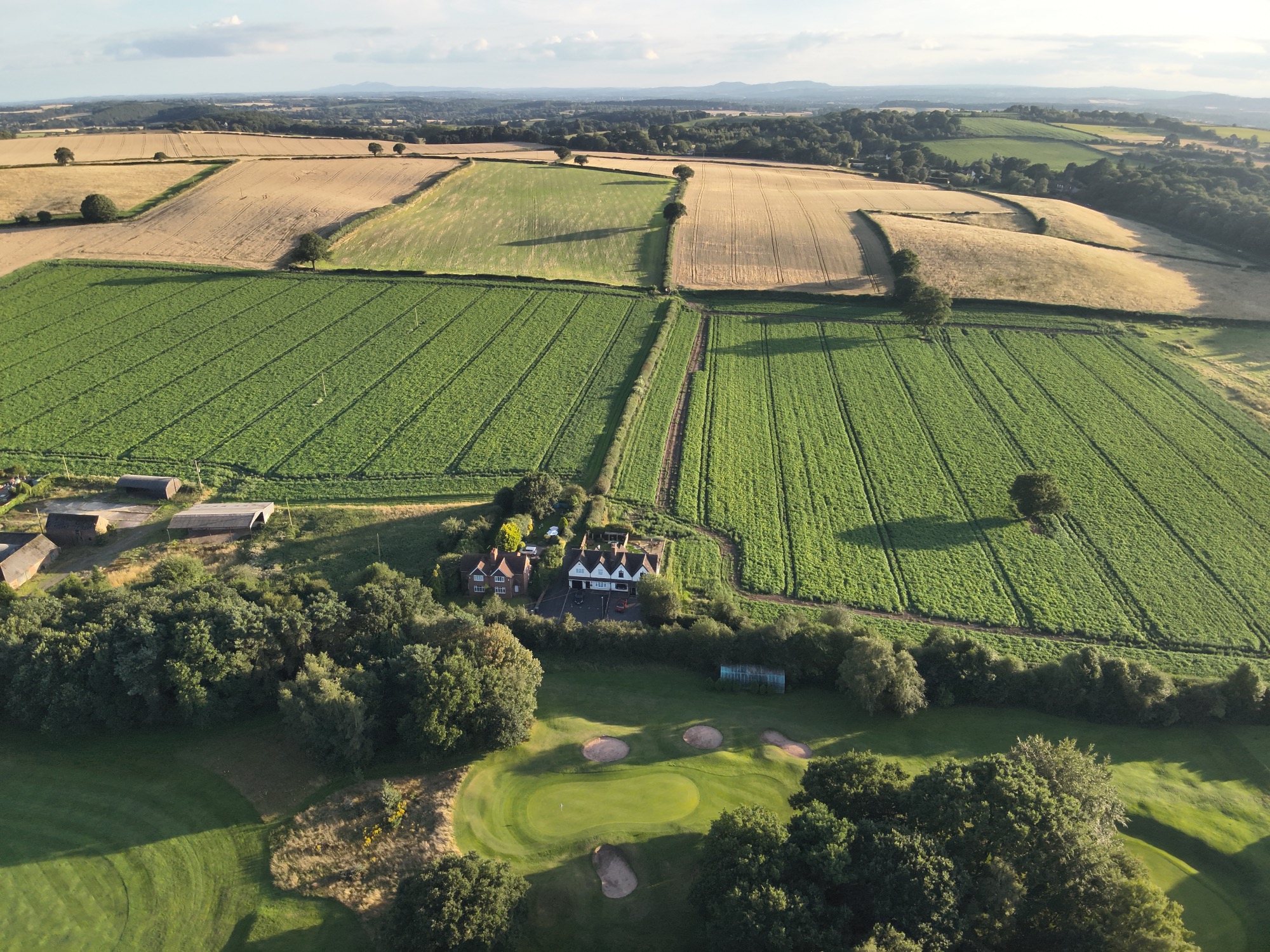
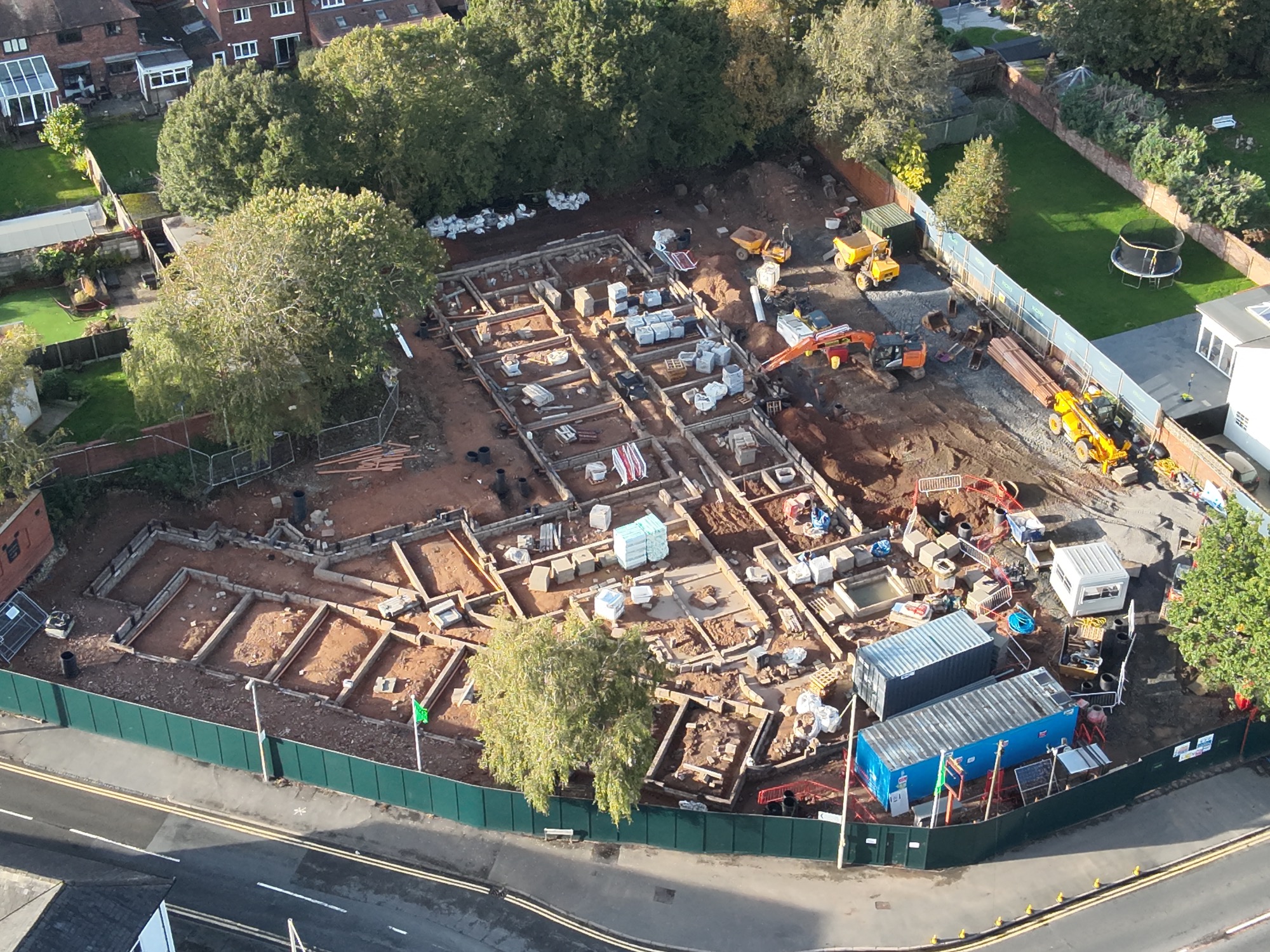
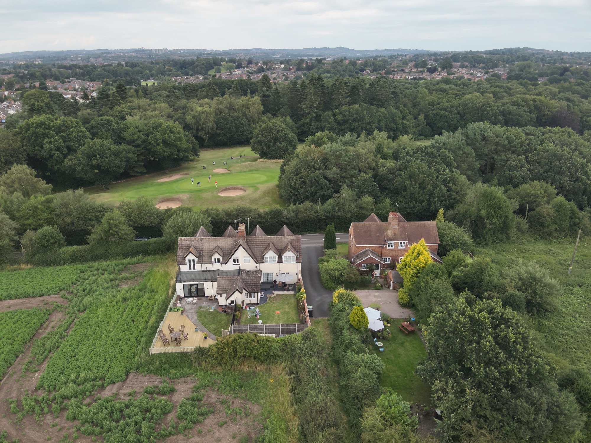
Real Estate Marketing
Drones have become an invaluable tool in the real estate industry, revolutionizing the way properties are marketed and showcased to potential buyers. Here's how drones are used for real estate marketing:
1. Aerial Photography and Videography: Drones equipped with high-resolution cameras can capture stunning aerial photos and videos of properties, showcasing them from unique and captivating perspectives. These aerial shots provide potential buyers with a comprehensive view of the property, highlighting its features, layout, and surroundings in a visually appealing manner.
2. Virtual Tours: Drones can be used to create immersive 360-degree virtual tours of properties, allowing potential buyers to explore the interior and exterior spaces from the comfort of their homes. These interactive tours provide a realistic and engaging experience, enabling viewers to get a feel for the property's flow and design.
3. Elevated Views: Drones can capture elevated views of properties, emphasizing their size, architectural details, landscaping, and proximity to amenities such as parks, schools, or waterfronts. These elevated perspectives can significantly enhance the attractiveness of listings and help properties stand out in competitive markets.
4. Site Surveys and Mapping: Drones can create detailed site surveys and maps of properties, highlighting boundaries, topography, and other relevant features. This information can be valuable for potential buyers interested in understanding the property's layout, size, and potential for development or landscaping.
5. Time-lapse Videos: Drones can capture time-lapse videos that showcase the property's transformation over time, such as construction progress or seasonal changes in landscaping. These dynamic videos can add a unique storytelling element to property listings, capturing viewers' attention and generating interest.
6. Cost-Effective Marketing: Using drones for real estate marketing is often more cost-effective than traditional aerial photography methods, such as hiring helicopters or planes. Drones can quickly and efficiently capture high-quality imagery and video, providing excellent value for money.
7. Competitive Advantage: Properties marketed with drone photography and videography often stand out from the crowd, attracting more attention and interest from potential buyers. The professional and modern presentation of listings can give real estate agents and sellers a competitive edge in the marketplace.
8. Enhanced Online Presence: High-quality drone imagery and videos can be shared across various online platforms, including real estate websites, social media channels, and listing portals. This multimedia content can drive engagement, increase online visibility, and reach a broader audience of potential buyers.
In conclusion, drones have transformed real estate marketing by offering innovative and visually compelling ways to showcase properties. Whether it's through stunning aerial photography, immersive virtual tours, or dynamic time-lapse videos, drones provide real estate professionals with powerful tools to effectively market properties and connect with potential buyers in today's digital age.
We are on YouTube
Check out our latest projects on YouTube @aerosurv.
Don't forget to like and hit the subscribe button!


We are on Instagram and X
Check out our latest posts on our instagram page where you can find upcoming offers, news and general updates.
@aerosurv on Instagram
@AerosurvLtd on X
Don't forget to like and follow!
We need your consent to load the translations
We use a third-party service to translate the website content that may collect data about your activity. Please review the details in the privacy policy and accept the service to view the translations.