
Who are we?
Aerosurv is a pioneering drone surveying company specializing in providing high-quality aerial data solutions for various industries. Founded on the principles of innovation and precision, Aerosurv utilizes cutting-edge drone technology to capture accurate, detailed, and actionable data for clients worldwide.
The company was formed by Ryan Jordan MCIOB an industry expert with extensive experience in surveying, mapping, and aerial imaging. Recognizing the transformative potential of drone technology in revolutionizing traditional surveying methods, i established Aerosurv with a vision to deliver unparalleled efficiency, safety, and insights to their clients' projects.
Driven by a commitment to excellence and a passion for pushing the boundaries of what is possible, Aerosurv's goal is to quickly established itself as a leader in the field of drone surveying.
With extensive knowledge and expeience in building management, safety and compliance coupled with state-of-the-art equipment and advanced data processing capabilities, enables them to deliver tailored solutions that meet the unique needs and challenges of each project they undertake.
From construction and infrastructure to agriculture and environmental monitoring, Aerosurv's innovative approach to aerial data collection and analysis is transforming industries and shaping the future of surveying.
With a focus on quality, reliability, and customer satisfaction, Aerosurv continues to set the standard for excellence in drone surveying services.
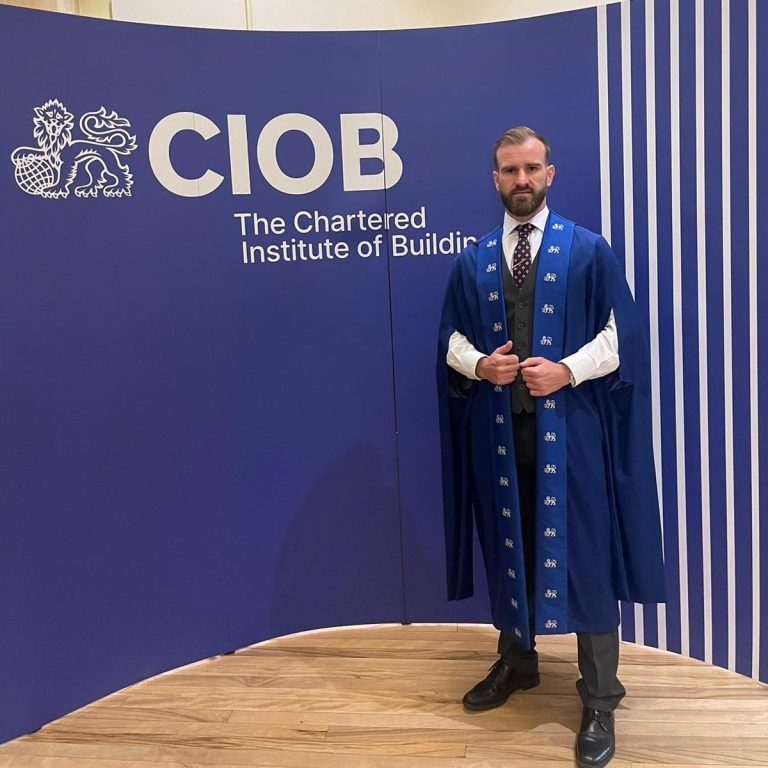
Meet the Managing Director
Bio
I am an experienced construction professional with a strong foundation in project management and building safety, honed through both academic achievement and hands-on industry experience. I earned my degree from Birmingham City University, where I specialized in construction management, further developing my knowledge in the built environment. My passion for excellence and commitment to upholding industry standards led me to become a Chartered Member of the Chartered Institute of Building (CIOB), solidifying my expertise in construction, project leadership, and regulatory compliance.
My career has been shaped by a deep passion for building safety and surveying, which took on heightened importance following the tragic events of the Grenfell Tower fire. This catastrophe underscored the critical need for stringent safety protocols, and I have since dedicated much of my focus to advocating for safer building practices. With a keen eye for detail and an unwavering commitment to ensuring that structures are not only functional but also safe, I have gained significant experience in surveying, risk assessment, and the implementation of safety regulations within the construction industry.
In addition to my work in building safety, I have embraced drone technology as a modern and efficient tool for surveying properties. My passion for flying drones allows me to capture detailed aerial data, assess building conditions, and identify potential issues in hard-to-reach areas. This cutting-edge approach to surveying enhances my ability to ensure the structural integrity and safety of buildings, merging technology with my construction expertise to offer comprehensive and innovative solutions.
Our Values
At our core, we are driven by a set of unwavering values that define who we are and how we operate. As professionals, we uphold the highest standards of integrity, ethics, and accountability in all that we do. We understand that excellence is not merely a goal but a relentless pursuit, and we strive to exceed expectations in every endeavor.
Pride in our work is not just a feeling but a guiding principle. We take ownership of our responsibilities, recognizing that our actions reflect not only on ourselves but also on our team and organization. We approach each task with dedication, craftsmanship, and attention to detail, knowing that our commitment to quality sets us apart.
We embrace challenges as opportunities for growth and innovation, pushing the boundaries of what is possible. We continuously seek new knowledge, skills, and perspectives, recognizing that learning is essential for progress. We foster a culture of collaboration and mutual respect, valuing diverse perspectives and contributions.
Above all, we are driven by a deep sense of purpose—to make a positive impact, to create lasting value, and to leave a legacy of excellence. Our values guide us in every decision and action, inspiring us to constantly raise the bar and achieve greatness together.
We strive to exceed
We are professional
We take pride
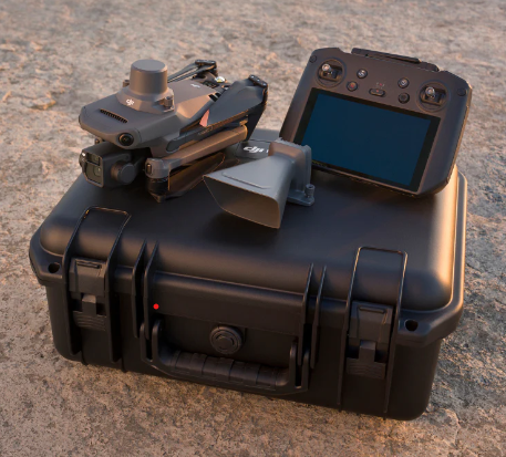
Benefits to using drones to help manage your assets
Using drones to manage property offers numerous benefits that can streamline operations, enhance efficiency, and provide valuable insights for property owners, managers, and stakeholders. Here are some of the key benefits of using drones for property management:
1. Aerial Inspections: Drones can conduct comprehensive aerial inspections of properties, including buildings, roofs, and landscaping, providing detailed insights into the condition and maintenance needs of the property. This allows for early detection of issues such as roof damage, structural defects, or landscaping issues, enabling timely repairs and maintenance.
2. Cost-Effective Maintenance: By identifying potential problems early, drones can help reduce the overall maintenance costs associated with property management. Regular drone inspections can help prevent minor issues from escalating into major repairs, saving property owners money in the long run.
3. Time-Saving: Drones can quickly cover large areas and access hard-to-reach or elevated spaces, reducing the time and effort required for manual inspections. This efficiency allows property managers to allocate their time more effectively, focusing on other essential tasks and responsibilities.
4. Enhanced Security: Drones equipped with surveillance cameras can monitor properties for unauthorized activities, trespassing, or security breaches, providing an additional layer of security and peace of mind for property owners and tenants.
5. Marketing and Promotion: Aerial photography and videography captured by drones can showcase properties in a visually stunning and compelling manner, enhancing marketing efforts and attracting potential buyers or renters. High-quality aerial images and videos can highlight the property's features, location, and amenities, setting it apart from competitors.
6. Property Development and Planning: Drones can assist in property development projects by providing accurate topographical maps, site surveys, and 3D modeling of the property. This information can aid in planning, design, and decision-making processes, ensuring efficient use of space and resources.
7. Environmental Monitoring: Drones can monitor and assess environmental factors affecting the property, such as drainage, vegetation health, and erosion. This data can help property managers implement sustainable practices, address environmental concerns, and maintain the property's ecological balance.
8. Documentation and Reporting: The data collected by drones can be compiled into detailed reports, complete with annotated images, videos, and recommendations. These reports serve as valuable documentation for property owners, insurers, and stakeholders, providing a comprehensive overview of the property's condition, maintenance history, and compliance with regulations.
9. Accessibility: Drones can access challenging terrains, elevated structures, and remote areas of a property that may be difficult or unsafe for humans to reach. This accessibility ensures thorough inspections and comprehensive coverage of the entire property, even in complex or hazardous environments.
10. Compliance and Regulation: Using drones for property management can help property owners and managers comply with industry standards, regulations, and safety guidelines. Proper documentation and regular inspections demonstrate due diligence and adherence to best practices, reducing liability and potential legal issues

Member of the Chartered Institute of Building
Being a member of the Chartered Institute of Building (CIOB) offers numerous benefits for professionals in the construction and built environment sectors. CIOB membership provides access to a wealth of resources, networking opportunities, and professional development initiatives that can enhance career prospects and contribute to personal and organizational growth. As a member, individuals gain recognition for their expertise, access to the latest industry knowledge and best practices, opportunities for professional networking and collaboration, and support for continuous learning and development. Additionally, CIOB membership signifies a commitment to upholding the highest standards of professionalism, ethics, and excellence in the construction industry, enhancing credibility and trustworthiness among peers, clients, and employers. Overall, being a member of CIOB is a valuable investment in one's career, offering a platform for professional advancement, knowledge sharing, and recognition within the construction profession.

ISO19650 Professional
ISO 19650, the international standard for Building Information Modeling (BIM), serves as a comprehensive framework for managing digital information throughout the lifecycle of built assets. It offers guidelines and requirements for the effective organization, exchange, and management of information within BIM processes. Here's how ISO 19650 can be utilized for BIM:
Standardization: ISO 19650 establishes standardized processes and procedures for BIM, ensuring consistency and interoperability across projects and stakeholders. This enables seamless collaboration and information exchange between different parties involved in the project lifecycle.
Information Management: The standard outlines principles for information management, including the creation, sharing, and maintenance of digital information related to the built environment. It emphasizes the importance of accurate, reliable, and accessible data throughout the asset lifecycle.
Workflow Optimization: ISO 19650 helps optimize BIM workflows by defining clear roles, responsibilities, and workflows for project participants. It streamlines communication and decision-making processes, reducing errors and delays during design, construction, and operation phases.
Risk Management: By providing guidelines for risk management within BIM processes, ISO 19650 helps identify, assess, and mitigate risks associated with digital information management. This ensures the integrity, security, and confidentiality of project data throughout its lifecycle.
Data Exchange and Integration: ISO 19650 facilitates the exchange and integration of digital information between different software platforms and systems used in BIM. It promotes the use of open standards and formats, enabling seamless interoperability and data exchange between various software applications.
Lifecycle Approach: The standard adopts a lifecycle approach to BIM, emphasizing the importance of considering information requirements and objectives across all stages of the asset lifecycle, from inception to decommissioning. This holistic approach ensures that relevant information is captured, managed, and utilized effectively throughout the asset's lifecycle.
In summary, ISO 19650 provides a robust framework for implementing BIM processes effectively, ensuring the efficient management of digital information throughout the lifecycle of built assets. By adhering to ISO 19650 guidelines, organizations can improve collaboration, minimize risks, and enhance the overall performance of BIM projects.
NEBOSH Qualified
Using NEBOSH qualified drone surveying for health and safety inspection provides a cutting-edge solution that enhances both efficiency and safety in various industries. By integrating NEBOSH expertise with drone technology, organizations can conduct thorough inspections of hazardous areas, infrastructure, or inaccessible locations remotely, minimizing risks to personnel. This approach not only improves accuracy in identifying potential hazards but also streamlines the inspection process, saving time and resources. Ultimately, leveraging NEBOSH qualified drone surveying contributes to a proactive approach to health and safety management, promoting a safer working environment and compliance with regulations.
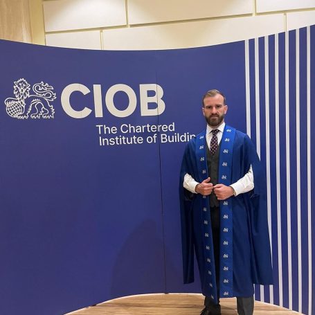
Ryan Jordan MCIOB
Managing Director
We need your consent to load the translations
We use a third-party service to translate the website content that may collect data about your activity. Please review the details in the privacy policy and accept the service to view the translations.